You are currently browsing the archives for the Tour and Travel category


Trek in Ranipuram

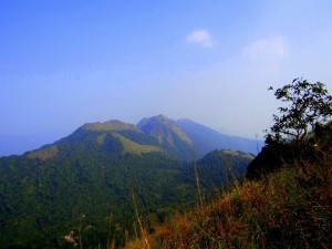
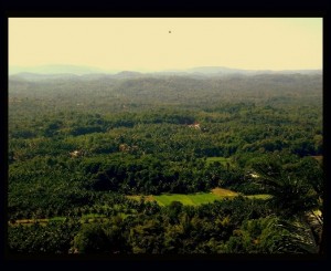
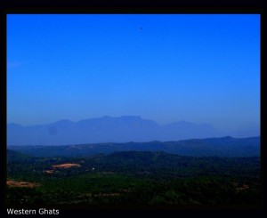
Located 750m above the sea level on the belt of Western Ghats in the Kasaragod Dist of Kerala, Ranipuram is a small hill station ideal for trecking and adventure sports. It is also called as Ooty of Kerala (Wikipedia). This belt is home for one of the Shola forests which is found in western ghats section of South India. The hillstation is well connected with roads from Kasaragod, Kanhengad and Mangalore.


How to Reach:

The hillstation is located at Panathady village in Hosadurga taluk of Kasaragod district. One can go from Kasargod or Kanhengad. From Kasaragod and Kanhengad it is approximately 55 Km and 48 Km respectively.
Near by Airport is Mangalore
Near by Railway Station is Kasaragod and Kanhengad.
Regular buses are available from Kasaragod and Kanhengad.

The Trek:

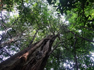
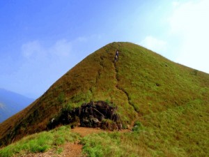
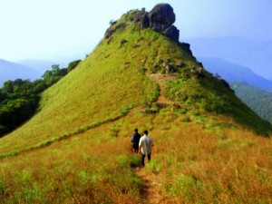
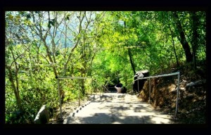
The trek begins at the KTDC Cottage. This is the typical forest route. One has to walk in the forest for apprximately half an hour to one hour. The ambiance of the forest trail is awesome. It is covered by large trees of different diversity. As and when you reach top of the hills the tree will disappear and the beautiful stretch of grassland will appear. From here the part of the way/climb is assisted by cut steps. As and when you reach top of the hill, you will get beautiful stretch of the vally. The total track time is approximately 2 hours.

For more information about the bio-diversity, floura and founa and other details, please visit Wiki

Amazing weekend at St.Mary’s Island

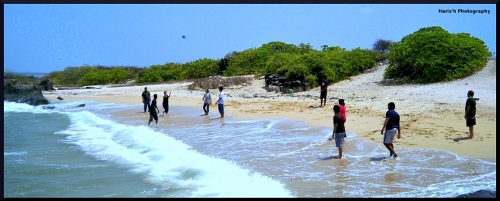
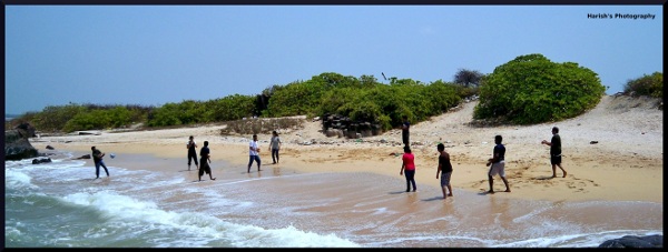
“Ok… we will plan…. which place do you want to visit this weekend?… decide… decide… fast….”. This was the words of Party Admin of our account. After hell lot of conversation / consultation / consideration / deliberation / examination and blah blah… we mutually decided to visit one of the beautiful islands in south India, the St. Mary’s Island. Well..the above was the introduction part about how we finally… decided the place. The partners in the picnic are my colleagues(13 member team). St. Mary’s Islands, are a set of four small islands in the Arabian Sea off the coast of Malpe in Udupi, Karnataka, India. Since the place is not far form Mangalore so we relied on the public transport to visit.

Mangalore to Malpe is one of the most beautiful tourist routes in the South Canara (now its in Udupi 🙁 ) district. The travel route begins in Mangalore and ends up at the city of beautiful beach Malpe. The 66 kilometers long travel route from Mangalore to Malpe is best accessible through road. Your camera stays busy thorough out the journey.

Little facts about the place

Malpe is one of the natural ports of Karnataka. The city is for about 6 kilometers to the west of Udupi. Malpe is famous for its beaches and group of Island. The mainland of Malpe includes four islands. They are

  • Daria-Bahadurgad
  • Daria-Gadara-Kalluthe
  • Kari-Illada-Kallu
  • Thonse Paar (we call it St. Mary’s Islands)

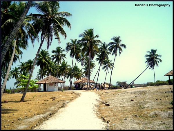
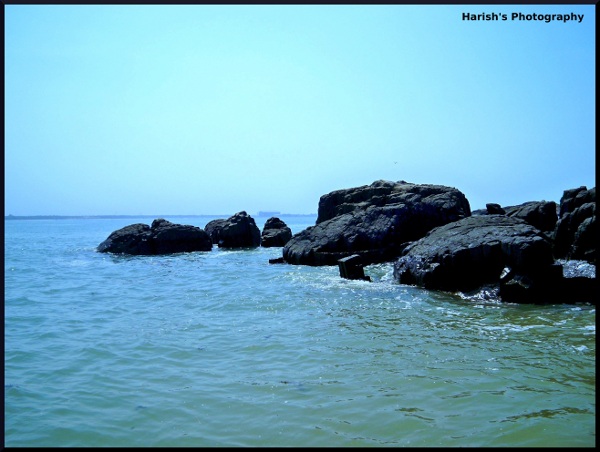
The island is home to basaltic rock formation in a hexagonal form, the only one of its type in India. It covers about an area of 500mX100m. The island is formed during the Deccan Traps, about 60 million years ago. Due to the impressive numbers of coconut trees, the island is also called as “Coconut Island”. Ideally the island has no habitation, but the colonies of Gulls, Sandpipers and a few crows can be sighted on the Islands

How we got in there..

The only way of getting to the islands is by boat. Regular ferry service covers the approx 7 km distance from the Malpe fishing harbor to the islands. However, the frequency of these boats may vary depending on the number of tourists visiting. The cost of the ferry service is Rs.80 per person(includes return journey). They consider minimum of 30 head counts per journey.

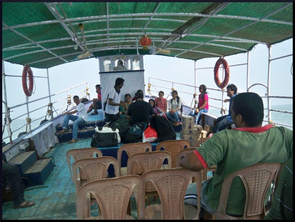
The ferry journey was for about half an hour. As soon as we enter the ferry… everybody started to search their favorite spot to sit, so that they can enjoy the ride. We started the journey comfortably. But the comfort started to vanish soon. As we entered the deep sea, it was getting rough. Since the ferry had a flat bottom, it started tilting sideways. Somehow we managed the situation and started to capture the journey through camera.. Everyone was in search their new profile pics for FB.

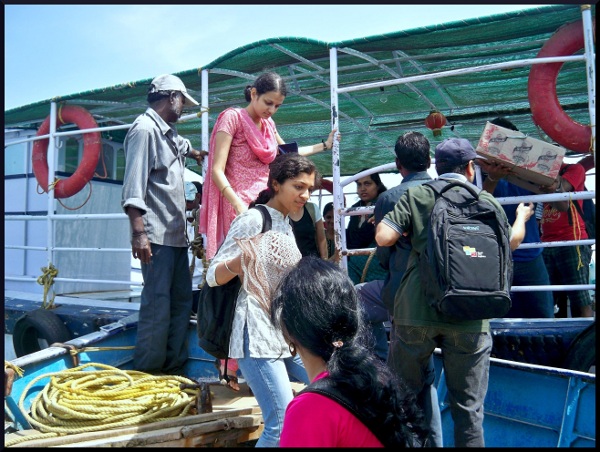
Since the ferry cannot go near to the island shore (because of rocks) we were shifted to small boat which took us till the shore. The island is dotted with coconut trees, and some huts to picnic under. But make sure you carry your water and food – you will get nothing here.

The Fun…

Useful Tips

Some of tips for the visitors

  • Carry enough water and food along with you
  • Cary First Aid box as there is no medical service available
  • Carry an umbrella if you are too conscious about sun burns
  • Don’t Litter. Take along a trash bag or other receptacle for collecting your trash so that you can deposit it in the proper trash receptacle.
  • Last but not the least… Swimming is dangerous. Follow the instruction of the sign boards and ferry owners

Sadashiva Temple -Narahari Parvatha (Hill)

Its been a while, I had never been for trekking… After coming to my Mangalore (from Bangalore), I was little busy to adjust my life to the Mangalorean environment. It took me a year to adjust. Life has become too industrious for me these days. So I took a break from my weekly routine and planned this trip. The Narahari Parvatha (Hill) always fascinated me. The hill is located adjacent to the NH No 48 (now renamed as NH-75). I planned to visit this place in my 2 months old Honda Aviator. As the scooter is new and I never took it for a long drive, I wanted to test the performance during the ride.

Location

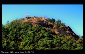
Narahari Hill is located on National Highway number 75 that connects Mangalore – Bangalore. The hill is located about 26 km from Manglaore. Once you reach BC Road junction its just 2 km away from there. It is located near the NH 75.

Since my home is 20 kilometers south to Mangalore, I took Mudipu -Melkar road to hit NH 75 at a place called Melkar. This is shortest route from my Home it is just 18 Km from Mangalore University. You can take this route if you are traveling from Thokkotu or Manjeshwara. (You can forget the Mangalore and NH 75 traffic congestions). Take the Mangalore University road from Thokkottu junction. After the Infosys Campus near a place called Kambalapadavu, travel for about 1.5 and then take left turn. (Landmark is near Indian Oil filling station). This road will connects to NH 75 at the place called Meklar. From Melakar junction the Narahari Hill is just a kilometer away. The road is well asphalted and a pleasure to drive. The vehicle cannot go to the top of the hill, you need to park the vehicle at down the hill. There are stairs to reach top of the hill, if you are interested you can take some other(typical trek) route to reach top of the hill.

The Trek

The vehicle cannot go to the peak of the hill. To reach the peak, you need to climb for about 160 steps. But don’t worry you can enjoy the natural breeze and sceneries during the trek. There are trees shades which will protect you from sun throughout the trek. If you have interest in Ornithology(Bird Watching) this is the place for you. I found different bird verities during the trek. Most of the name I don’t know but to name some-Indian Parrots, Woodpeckker, Babblers, Maina, Bulbul. Peacock etc. You can also explore near by forests.

Sadashiva Temple and Surroundings

The hill is famous for the Sri Sadashiva Temple. The temple is dedicated to Lord Shiva. This is one of the oldest temple of Karnataka. It is believed that Nara and Hari, incarnations of Lord Vishnu were supposed to have performed the penance at this place. The temple is also known for its ponds. The ponds are in shape of Shanka (Conch), Chakra (Wheel), Gadha (Heavy Weapon) and Padma (Lotus).Nature is at its best at the top of the hill. One can enjoy the panoramic view of the surrounding with the cool breez. Do not forget to take the camera. This place is filled with sceneries. The temple committee has made arrangements for seats to sit and enjoy the nature beauty. To the west side, you can see the Arabian Sea and to the east side you can enjoy the lush green western ghats. We can also spot the Charmadi Ghat from here.

Visiting Season

The best period to visit this place is during the monsoons. July to December would be the ideal time. If you visit during monsoon season, entire area around the mountain will be lush green and you may even be lucky enough to see low level clouds around the peak. Morning between 7 to 10 is the best time to visit the place.

Precautions

Carrying food and water would be good. Once you cross Melkar you wont get any shops and restaurants near by. There is small shop near at the hills, but you cannot relay on them. Do not dare to forget the umbrella during the rainy season.

Temples of Keladi and Ikkeri

This is second part of the Shimoga Trip. In this part I am writing about the fine temples of Keladi and Ikkeri. Keladi and Ikkeri were under the regime of Nayaka Dynasty. Nayakas of Keladi were an important ruling dynasty of post-medieval Karnataka, India. They initially started to rule as a feudatory of the Vijayanagar Empire. After the fall of the empire in 1565, they gained independence and ruled significant parts of Karnataka including Shimoga.

Art and Architecture

The temples were built in Dravida style of Architecture (a perfect blend of Kadamba, Hoysala and Vijayanagara). They used granite for the constructions. The Aghoreshwara temple at Ikkeri and the Rameshwara temple at Keladi are the best examples of the Nayakas’ art.


Aghoreshwara Temple

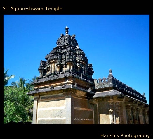
This magnificent temple is in Ikkeri, capital of the Keladi Nayakas situated 3 Kms from Sagara, Shimoga district. Ikkeri in Kannada means two streets. The temple is dedicated to Lord Shiva. Aghoreswara means ”the lord of 14th night of the darker half of Hindu month of Bhadrapada” . This unique temple is built in using laterite material, which is abundantly found in this part of the world. The architecture of the temple is in blend of Hoysala and Vijayanagara style.


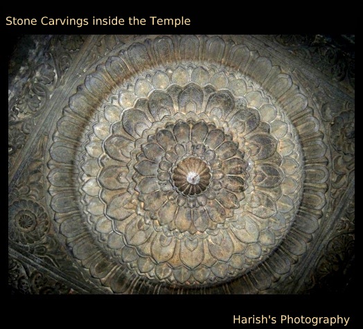
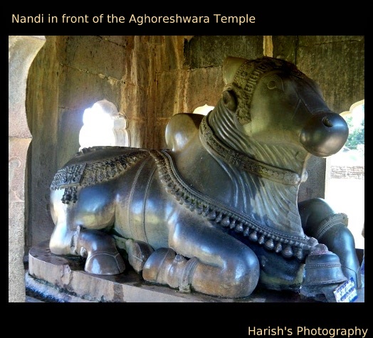
The statue of Nandi which is located in front of the temple is an example excellent work of sculpture. The Nandi resides in the Mantap which is decorated with artistic stone engravings. The temple is a huge structure with the three gates, one is the main gate at front, and other two are in the left and right side of the temple. The original deity of the temple which had 32 hands is revered as an innovative creation. The idol was destroyed during the attack of Sultans of Bijapur. Lamps and other damaged structures indicate that the idol was over 10 feet in height.Only the ornate pedestal on which the deity was placed remains now and a Shiva lingam has been erected on it. On the either side of the shrine, there are broken idols of various gods and goddesses. Beside the main temple, there is a shrine dedicated to Goddess Akilandeshwari. Both temple’s ceilings are adorned with intricate carvings.

Rameshwara Temple

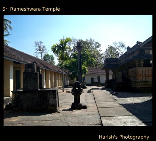
The temple is popularly known as Keladi Rameshwara Temple. The shrine has three deities, Devi Parvathi, Lord Rameshwara and Lord Veerabhadra. The temple was built by Chowdappa Nayaka. The temple is in dravidian style of architecture influenced by Kadamba and Hoysala style. The roofs and pillars of the temple is made out of carved wood.

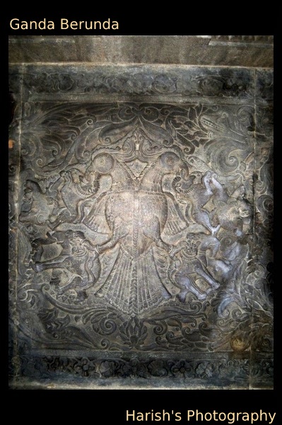
The stone sculpture of Ganda Berunda on the ceiling of the Veerabhadra temple is exquisite.(It is used as logo for Karnataka Road Transport Corp. KSRTC) It is a depiction of a two-headed garuda (a mythical bird) holding lions with its beak and elephants with its claws. This dwajasthambam is said to be erected during the regime of Keladi Chennamma. Temple has a museum in which many ancient artefacts are carefully preserved. It has the collection of rare artifacts like swords, combs, manuscripts, coins and brass idols.

I also visited small village called Varadahalli. Its where Shree Shridar Swamiji attained the Moksha or Nirvana (Divine bliss). The place is 6 km from Sagar. Its been said that this divine place in Western ghats was the chosen place of Maharshi Agastya and Veda Vyas to do Sadhana thousands of years ago.

.

The journey was incomplete as there was time constraint. I had only two days of time to visit Shimoga. Anyways there is always ‘next time’ to explore more places.

Sigandooru… In the backwaters of Sharavati

Whenever we hear about the word ‘backwaters’… the only state of India which come into the mind is Kerala…. undoubtedly Kerala is home to the most beautiful backwaters on the planet. Last month (Dec2010) I visited the place called Signadooru… a small village in the backwaters of the river Sharavati (Linganamakki reservoir).

The trip was an unplanned. My relatives went to attend a marriage function at Sagar, a beautiful place in the Shimog district. Since the next two days are weekend they planned to explore near by places. So I got the invitation to join the group. I managed to get a bus from Mangalore to Shimog on Firday night.

The Bus Service to Sagar

Only two buses are there from Mangalor. A private company Gajanana Transport will run daily two buses to Sagar. The bus timings are as follows

Bus Name Timings
Durgamba Travels 21:30 hrs
Gajanana Travells 22:30 hrs

Buses will reach Sagar at around 3:30 hrs and 4:30hrs respectively. The capital city Bangalore is well connected with Sagar many Government (KSRTC) and Private buses have their daily trips. From Bangalore the Sagar is approximately 350 kms

The journey…

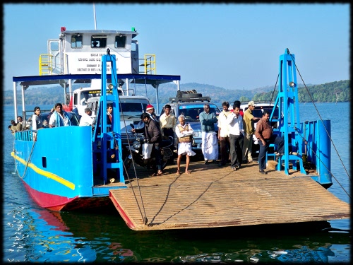
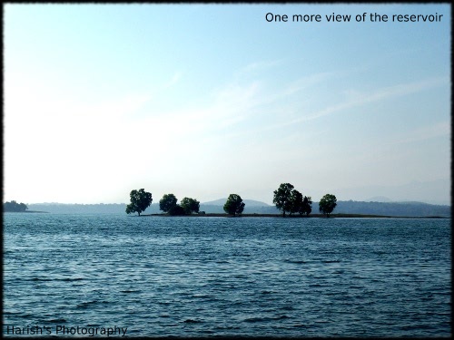
We started from Sagar at around 07:00 hrs. As we had our private vehicle, we choose the Avinahalli and Ambaragodlu route to reach Holebagilu. The are belongs to Sharavati Reserve Forest. Although it is a reserved forest one can see human inhabitation on the way to Holebagilu. This is the place where the backwater starts. The is called as backwater because of a huge dam constructed across the river Sharavati at Linganamakki. Karnataka’s half of the electricity demand is satisfied by this dam. The stored water of the dam penetrates into the wast areas of land. According to a local people more than 100 big villages, submerged during the construction of this reservoir. I have read and heard the pain that were undergone by the people in this part of the world during the construction of this dam. Before the reservoir this was the route which connects Sagar and Nittur (NINASAM, a cultural organization dedicated to the growth of drama, films and publishing). The best part was the journey in the Barge. Only during the barge journey one can feel the vastness of the reservoir.

Devi Chaudamma Temple at Sigandur

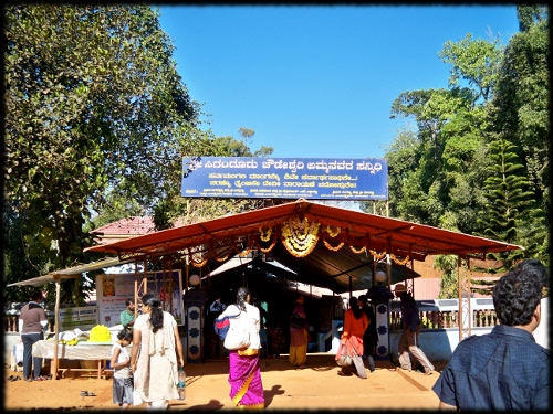
Singandur, the place is located in the other side of the reservoir. Devi Chudeshwari Temple is located in this place. The temple is dedicated to Devi Chaudamma. Its been believed that on wearing of the brass tag which is available in this temple will protect house and the belongings from the thief. During Sankrathi (January) Jatra (festival) is celebrated in this temple.

A Round of Siddara Betta

It is my fourth visit to Tumkur. Everytime I traveled through the National Highway No. 4 (Bangalore-Pune NH) road, I always used to wonder about rocky mountains on either side of the road. Being a nature lover, I always wanted to visit each and every rock personally. But practically speaking it is not possible. So I have chosen some of the famous Rocks of Tumkur. My aim is to treck some of the rocks of Tumkur.

There are lot of such rockiest places in Tumkur district. To name some of them, Devarayanadurag, Shivagange, Madhugiri, Chennarayana Durga.. and many unknown ones. In this post, I share my experience of Siddara Betta. One of the famous rocks of Tumkur district.

It has been said that many hermits had performed the meditation in the caves of Siddara Betta. Siddara Betta is rich in natural beauty. It is paradise for nature lovers. It has rare species of herbal plants.

Situated in Koratagere taluk, Siddara Betta is approximately 97 Kms away from Benagaluru. It is ideal place for cave exploration and trecking. The KSRTC provides bus services till Koratagere. From there private buses will take you to the Siddara Betta.

Information

Total Distance From Bengaluru 97 Kms
Koratagere (Nearest point) from Bengauru 75 Kms
From Koratagere to Siddara Betta 18 Kms
Nearest Food point Koratagere (Udupi Hotel)
From Tumkur to Siddra Betta 35 Kms (aprox)
Cellular Service AirTel, CellOne and Reliance

The journey began from Bangalore. I and my friend started from Majestic. It was totally an unplanned journey. After we reached the KSRTC bus depo, we planned to visit Tumkur first, and from there to Siddra Betta. But, luckily we could catch a bus which goes to Korategere. The journey was quite ok. We collected as many information as possible from the passengers and the bus conductor about the place. After two and half hours of journey, we reached the Koratagere taluk.

Koratagere is a small village. As soon as we reached there, we decided to have a break-fast. We saw one Udupi Hotel and we broke our past at around 12 noon. While having the break-fast, I collected as many information as possible from the owner of the hotel. He recognized me as Mangalorian by listening to my Kannada. According to the hotel owner, in every hour there wil be a private bus which goes to Tumkur via Siddara Betta.

We caught one private bus and spent 45 minutes with the bus standing idle. I hate private buses (but there was no choice). Last time when I went to Shivagange, I traveled in a “Noicy Box” (In Bangalore every private bus is equipped with a small ‘Bus Theatre System’ and they usually play some movie with a high volume). It was one of my worst private bus journeys ever.

Finally, the bus started to move. We have enjoyed the scenic beauty of the nature while traveling. We also got a chance to see the Chennarayana Durga. The weather was awesome. It was drizzling frequently and the a mild fog covered most of the rocks. As we were leading towards the top place, we could sense the drop in the temperature. When we reached the destination the rain also increased its intensity. The whole Siddara Betta view was covered by the clouds and fog.

We had hardly two hours of time to treck the Rock. We decided to treck till cave template. We started off quickly towards the Rock. We had to walk a distance of half kilometre to get the foot of the Siddara Betta. It was raining as we reached the foot of the Siddara Betta. We were in dilemma as to treck or not. Finally we decided to treck as much as possible. (Because trecking is risky during the rain, the chance of slipping is more). It was hard for me to treck the initial 25 steps. The wind blowing was so cold that I felt it is difficult to breath the chilled air. Very quickly, I adjusted to the atmospheric condition.

As we were moving further, the weather became more violent. The whole Siddara Betta was covered by thick fog. It was very difficult to watch ahead. I am sure that the scenery from the Betta is beautiful but the cover of thick fog did not allowed us to enjoy the awesome view. It was very difficult for us to treck. As we climbed up, the temperature stated to drop. We were not prepared at all to face this situation. We didn’t have proper accessories to deal with this kind of weather. But still we managed to move ahead.

There are stairs which will take you to the cave temple. In the middle, the stairs are not carved properly. So we had to take double precaution while treckking.(doubble, because of rain). It was disastrous to treck with chappals or with the plain shoes. Either we need to have special treck shoes or we have to walk bare footed.

Even though the atmosphere was rough, it was wonderful. It was a memorable experience to treck in this situation. We successfully captured some of the glimpses of the nature. Siddara Betta is filled with variety of vegetation. The natural spring on the hillock is known for its medicinal value. A wide variety of medicinal plants are grown in this rock. The fresh air of this betta is natural remedy for respiratory related problems such as astma, bronchitics etc. It also has mythological significance. It was the same betta where Lord Hanuman had collected sanjeevani to save Lakshmana during Ramyan war in Treta Yuga. The betta is filled with the nature wonders. Various species of birds can be seen in this region and it is the natural habitat of the yellow throated Bulbul bird.

After trecking for about 45- 50 minutes, we managed to reach the cave temple. Here Shiva is called by the name Siddeshwara Swami. We did not plan to go into the cave and explore it. We just visited the temple. Here the temple was not built; but it is a natural cave temple. It is dark inside; there are lights, but as usual, no power. There is a theerth (water source) inside the temple. It has been said that, the theerth has got medicinal values. As we headed out of the cave, we started to ask the localite about the cave. According to the localite, the cave is wast and confusing, the chances of getting lost inside is high. The cave has connecting route between Shivagange and Bangalore (it will join the Gavi Gangadhareshwara Temple of Bengaluru). The cave temple is situated in the middle of the hill. We were interested to treck further, but the time and the weather didn’t allow us. So we decided to start our journey back.

Every expedition will emerge as an experience. It was an memorable experience for us. We enjoyed every moment of the time that we spent in Siddara Betta. At the end of the day the journey was incomplete, we didn’t experience the top, nor the thrilling dark caves of Siddara Betta, but still we enjoyed ‘the day’ in our life.

Safari in Bannerughatta…

It took me really long time to include one more post in my blog. This post is about my safari in one of the National Parks of India, which is situated near to Bengaluru. Yes, I am talking about Bannerughatta National Park. I got an opportunity to visit this place along with my friends (Nithin Kamath, Muralidhar Kudva and Pranesh Kumar).

How to Reach?

Bannerughatta is well connected with road. There are plenty of Bus services available from Bengalure. The BMTC has very good bus service from Majestic, KR Market and Banashakari. Also you can catch private bus from Banashakari. BMTC provides Volvo Bus service to the National Park. The route number 365 and 366 buses will directly reach the National park.

The Journey

We started at 9:15 A.M. from Banshakari along with bus route number 201 which goes to Domluru. We got down at Jaideva Heart Foundation, and caught a bus from Bannerughatta road. Unfortunately, the bus we caught didn’t go to the National Park. We got down at Bannerughatta village and started walking towards the National Park. The park is situated at a walkable distance from the village. The weather was perfect for a walk; it was drizzling and fantastic. We reached the park at around 10:30 am.

In the Park

As an entrance fee you are charged Rs. 35/-, but if you are interested, you can have the thrill of Safari, Grand Safari, Nature Walk (Short), Nature Walk (Far), Elephant Ride etc. with additional charges. We decided to go for a Grand Safari. The fee for the Grand Safari is Rs. 125 (it includes lion safari, tiger safari, and bear safari).

We started the safari at about 11:00 am. For about an hour we saw the wild animals in their natural habitat. We could see bison, deer, elephant, bear, lion, and tiger. The park authorities have maintained the park very well. It is a plastic free zone. No plastics are allowed inside the jungle. You will find sign broads stating – “Plastic Free Zone” here and there.

After the grand safari, we went to the park. The park has got a zoo, where all rare species of birds, animals and reptiles preserved. One can see various kinds of birds, mammals, reptiles and lot more.. There is museum inside the park, where lot of information about the wild life is collected and preserved. There is a small theater, used to show the documentaries and short films about the wild life and jungles.

The world of Butterflies

The butterfly park is very attractive and beautiful. You can have a short and nice walk to reach the butterfly park. The distance between national park and the butterfly park is about 1 km. You have to pay an additional fee of Rs. 20/- as an entry fee. The park has got everything about butterflies and moths. It is maintained very well. The closed huge green house like environment with lots of flowers and fauns and artificial streams is well suited for the butterflies. If you are lucky you will find some rare variety of butterflies and moths. You have to struggle a lot to find the butterflies in the jungle like environment. The butterfly park has got a museum, which shows lot of information about unexplored world of butterflies. It has collection of various kinds of moths and butterflies. There is an exhibition, which throws light on the life cycle of the butterflies. Really, I came to know about lot of things about this small and beautiful creatures of the world.

What if You are Hungry?

No need to worry about your stomach. There are lot of canteens which are ready to serve you. We went to one canteen inside the park. It is KSTDC’s canteen. They charge a reasonable price for the food. Meanwhile you have other choices outside the park. So don’t worry about your stomach.

Some important tips.

Bannerughatta National Park is a plastic free zone. No one is allowed to carry any kind of plastic inside the park. The park security have done good job in this regard. If you carry any kind of snacks inside the park, the security will take the plastic cover and give the contents within it in paper bags. In spite of that, I have seen lot of plastics. It is our responsibility to avoid the use of plastics in the park.

There are clear instructions given everywhere in the park that one should not feed food to the animals. I have seen lot of people violating this rule. There are no proper security measures to take care of these things. So if you find anyone doing favor to the animal by giving eatables please stop them.
Someshwara-Long time after a break

It is my favorite hangout place. Yes it is one of the coolest place of Mangalore. Whenever I get free time during evening, I used to spend in this place. Lot of memories of my life is associated with this place.

During my high school days, I was introduced to Someshwara, a small coastal village near Ullala. I done my high schooling in Anandashram High School, Someshwara, which is located half a km from Arabian Sea. A school which has glorious history of more than 50 years in the field of education .

This village is called Someshwara because of Sri Somanatheshwara Temple. A historical temple built during the regime of famous queen Rani Abbakka Devi in 16th century.

I and My Best Friend (who went to ‘other world’) used to spend hours together in this beach. However busy we were in our personal/professional life, we never used to forget to meet on every Saturday. The place as around 8 Km’s from our home. I relied on my Bike to travel this distance. We used to stay in the beach till the Sun goes down.

On 2nd May 2008, I went Someshwar almost after a year, to attend the Old Friends Meet held at Ananadashram High School. All teachers of our batch plus some students had attended the meeting. Almost after ten years we met each other. Some faces are changed and some are unchanged, some are married and arrived with their children.

It was my honor that, I was invited to this Meet. The meeting began with the breakfast with friends and teachers. After the breakfast, we had a reintroduction session, where we reintroduced ourself . After we finished with the introduction, we went to each of the class room, we sat on the benches in the same order where we used to sit during those days. After that the fun section began, a lot spot games were arranged for teachers and students . They also arranged soccer and cricket. After 7 years I played soccer – a favorite game of mien during school day. Totally, it was day of recalling all the memories and sharing best movements of those days with our friends.

After the lunch, we went to the school library. It was our routine to visit the library after the lunch during the school days. I read few books in the library. We also visited the PU college, which is built recently.

Evening we all went to Someshwara Temple and Someshwara beach. We spent almost an hour in the beach. We all Climbed the ‘Rudra Shila’ a big Rock near to the beach. It is one of the attractions of the Someshwara. We all had fun during trekking. Watching the sunset from this rock is amazing experience

Dinner was arranged in the Summer Sand Beach Resort near to Ullal. We all went there, it is around 2 Km from Someshwara. We had nice dinner in the resort. A musical event is arranged for us by our juniors. We had a lot of fun in participating in the show.

Altogether it was a great day in my life. It is nice to arrange this kind of meet. It will give immense pleasure to share your experience with your friends and also listen to some of their experiences. I personally learned a lot from this Meet.

Antaragange- Kashi of South India.

Last weekend I visited a place called Antaragange, popularly known as Kashi of South India. This post gives a briefing of the wonderful and adventurous trip. Antergange is situated in Kolar district of Karnataka state. It is just about 4 Kilometer from Kolar Bus Stand, and 70 Kilometers from Bengaluru.

How to Reach

There are plenty of Buses which connect Kolara, district headquarter with Bengaluru. Both KSRTC and private buses will go to Kolara. Private buses, will depart from Majestic as well as from KR Market. It will take one and half or maximum of two hours to reach Kolar depending on the bus. From Kolara, the destination is near. It is approximately 4 kilometers. You can go by walking by enjoying the side scenes and nice environment (just like me) or you also have an option to opt for a auto rickshaw. The fair is Rs.30/-. But before getting into the rickshaw, please clarify about the fair with the driver. This route won’t go to the top of the hill. From the enter ace you have to climb approximately 350-500 steps. There is another way which is constructed recently, which will take you to the top of the hill.

Its Rocky

The hills of Antergange provide an ideal location for Outbound Training and Excursions. Scattered thorn scrub forests amidst volcanic rocks and boulders present an irresistible landscape, where different adventure activities can be undertaken. Activities include · Nature study, · Trekking & rock climbing, Over night camping, Night navigation, Cave exploration.

Main Attractions

Kashi Vishweshwara Temple is also one of the main attractions of Antargange. The name ‘Antaragange’ means “Ganges from deep” in Kannada language. There is Basava (bull) made out of stone, water streaming out from the mouth of a stone bull Nobody knows the source of water or the place from where it originates. Water is seen streaming out throughout the year. It is been said that the source of this stream is from the holy river Gangaa. There is small Kalyani (pond) near the temple. The main deity of the temple is Kashi Vishveshawra(Lord Shiva). The temple is made out of rock. There main Shiva Lingam in the temple. Along with the Main Lingam, there are around 4 to 5 Lingam in the side of the main mantapa.

Trekking

Behind the temple there is way to the forest. From this point you can start the trekking. You will find some stairs at the beginning of the trekking, but it will disappear as you go further. The path is full of stone, scattered cactus, thrones and Bushes. Ideal place for adventure. If you follow the pylons (power cables), it would be very easy to climb the hill. There are a lot of trees such as Nilagiri, Akeshiya, Amla. There are various spicies of cactus are available in this region. As you go to the top, you will find a nice view of Kolara city. There are volcanic rocks of various size. Some rocks are laid in such passion that it appear like natural caves.

Antergange is overpopulated by monkeys. They are wild monkeyss. They literally grab anything from the visitors. It is very dangerous to leave our belongings from our hand. Some monkeys are so clever that they grab the things from our hands. One should be very careful while transacting with the monkeys.